
With the Bank Holiday Weekend internet crash, I’ve got a bit of a back log of blog posts, and this was originally intended to be posted in the middle of last week. Thankfully now the satellite is working again I’ll be sure to bring you up to speed in the next couple of days!
With all the airguns rounded up and the shooting complete, Monday marked the start of the big recovery – we had to collect all 48 ocean bottom seismometers (OBS) from 5km under the sea. Standing up on the bridge of the James Cook with baited breath, a team of nervous scientists and a ghost-busters style radio detector, I’m not afraid to admit it was quite exciting. Sure enough just a few hundred metres from the ship as my reader beeped hysterically, there were the little orange flags we’d all been looking for – OBS 1? Check!
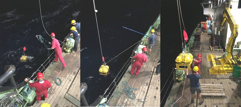
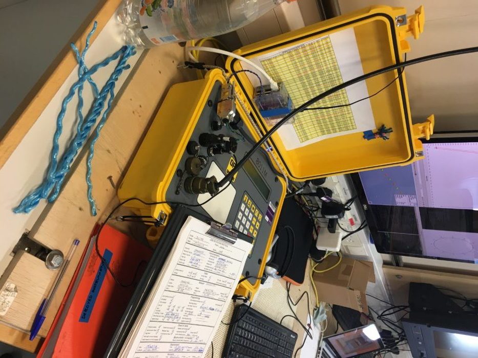
Each instrument may take 2 hours or more to be recovered, and so we have 4 or 5 days ahead of us now, collecting in the OBS before moving into International Waters and doing it all over again. In order to release them from the sea bed, we send high frequency signal, deep into the water in order to “communicate” with the OBS – most of the devices trigger at 12kHz. Each has a unique trigger code, and when a response is received the instrument is released from its frame and rises to the surface, at around 70cm per second. They can then be retrieved and lowered onto the deck with the crane.
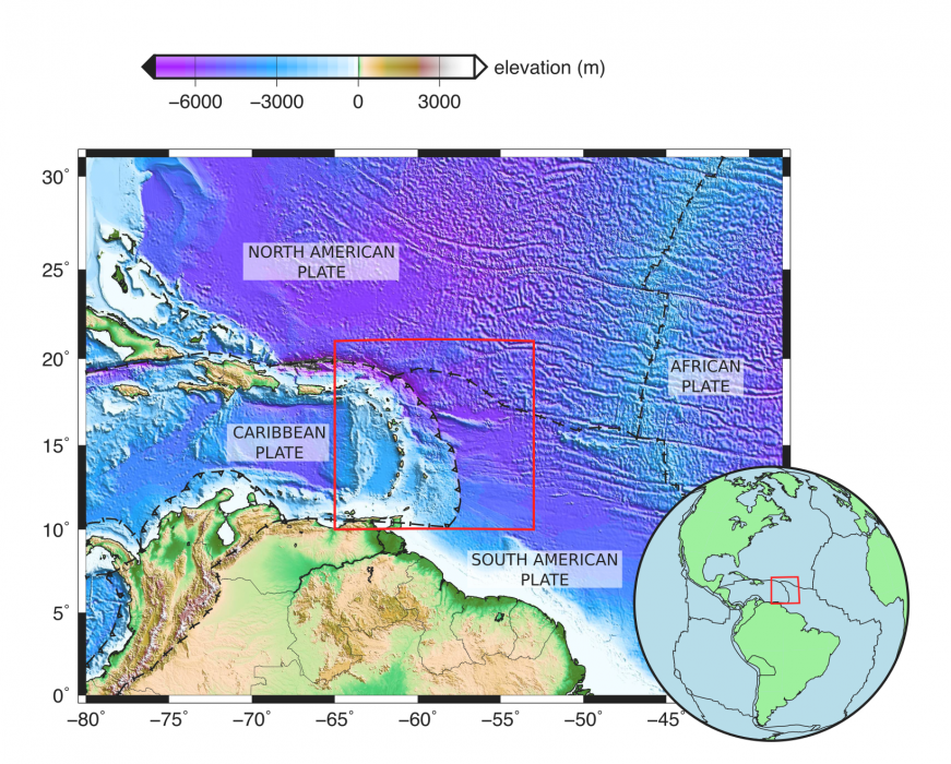
As we wrap up this survey line and venture further out into the Atlantic, it seems a good time to introduce the Antilles a little better, and what we’re looking to study during Leg 3. The Lesser Antilles is the collective name for the islands that lie in the very East of the Caribbean in an arc shape. They are a chain of volcanoes that have had a complex history. Near the middle of the arc, at Martinique, the arc actually splits in two. The inside curve of the arc is active and often eruptive (this includes islands commonly reported in the news, such as Montserrat) and to the north the outer arc is now inactive. It is in active subduction zone, where the North and South American tectonic plates are forced beneath the Caribbean.
The North and South American plates were formed at the Mid-Atlantic ridge and are old cold dense basalts. They contain a certain amount of water, absorbed from the ocean above. When these oceanic basalts are subducted they release some of this water – a process called dehydration. This in turn causes partial melting in the mantle, that lies beneath the plates. Melting the mantle makes magma and when this surfaces creates a volcano. This simple process is how the island arc came to be, but the significance of the water is the topic of interest in this case. How much fluid, and what kind of fluid may determine the characteristics of the volcanoes in that arc. After all there are volcanic arcs all over the world, particularly around the Pacific, for example, Japan. The Atlantic mid-ocean ridge, however, is very different to the Pacific as it spreads much more slowly. Perhaps by understanding the role of fluids here in the Caribbean system we may be able to better categorise these island chains.
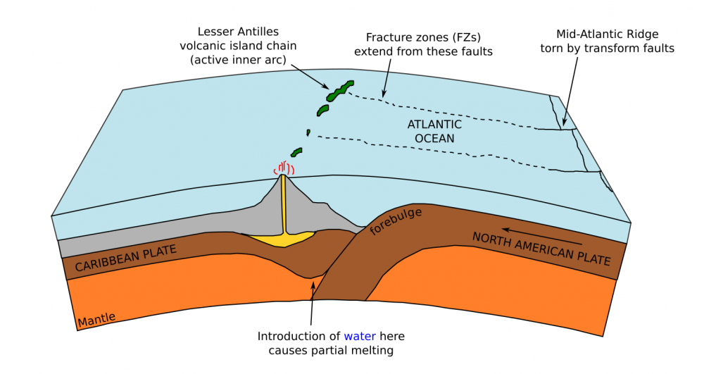
As well as simply being present in the basaltic minerals, water can find other ways into the oceanic crust. The Mid-Atlantic ridge is not straight – it has been sheared many times by transform faults. These resulting fracture zones (FZs) extend all the way to the edges of the ocean, including the Lesser Antilles. These FZs are easy conduits for fluids to enter the crust. These fracture zones are the targets of survey lines 2 and 3 in this third leg of the cruise. Traversing North to South over 325km we hope to cross 2 of these potential zones where water may be entering the system.
The first survey line that we are in the process of completing lies over what we call a ‘forebulge’, where the subducting plate tends to fold and bulge upwards before being bent down beneath the Caribbean. This may contain tiny faults where the basalts have fractured and failed. These, like the large scale FZs from the Mid-Atlantic ridge are a passage for water into the system.
Now the airguns have stopped firing we have some of the reflection data available in print. Some initial scouring shows nicely the shape of the forebulge but further processing will aid a more detailed interpretation. For now, we’re continuing to collect the OBS, before venturing out to our ‘soggy’ fracture zones on the Atlantic.