
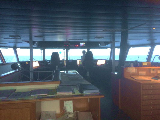
We’ve made it to Guadeloupe – the third and final leg of cruise JC149. After a successful 10 days at sea for leg 2, this second docking in Pointe-a-Pitre marks the half way point and sees another science party change over, and all aboard are raring to go. The new arrivals to the watch keep team includes myself (Sophie), Caroline, Chen, Ben and Gabriella, as we uptake our duties and eagle-eye watch in the lab to ensure the incoming acquired data is sensible and all of the instruments are performing well. After settling into our cabins, getting acquainted with the endless staff and crew on board and adjusting to our shift patterns we were ready to set sail. Many of the crew on board are on 4 hour shift rotations – work for 4 hours, rest for 8 hours, work for 4 hours, sleep for 8 hours, repeat. I have been assigned the 12-4 shift and even a week in, it still feels strange bobbing about on a very quiet ship at 3 in the morning, as though it’s the middle of the day. A challenging first 48 hours at sea, with 5 newbies, jet lag and the choppy Atlantic to contend with, I’m pleased to report with some initial successes for leg 3!
An aside about myself, before the science-y part! I’ll be taking over blogging duties for the next 34 days out of dock, so I had best introduce myself and what I’ll be posting about. I’m Sophie, a 4th year undergraduate Geophysics student at Imperial College. I completed my MSci research project this year, which involved magnetic anomaly modelling over the Lesser Antilles arc (in the east Caribbean) using data acquired when the James Cook was here last March. Supervised by Jenny Collier (Principal Scientist for this cruise) I was lucky enough to be invited out to join the watch keep team this year. It’s going to be a massive learning curve but I’m excited to see some really exciting science in action and learning how research is done.
This final part of the cruise will consider short period deployment and acquisition across 3 carefully chosen survey lines; this is in contrast to some of the long term aims of the previous 2 legs. The first survey line lies 18 hours sailing out of port from Guadeloupe and according to interpretations from the gravity and bathymetry data, should lie approximately where the North American plate is forced to bend beneath the Caribbean plate and bulges upwards. The remaining 2 lines follow on from one another and traverse North to South, across fracture zones extending from the Mid-Atlantic Ridge. It’s suggested that both the ‘bulge’ and these fracture zones are possible conduits for water to enter the deep Earth. Small amounts of water in the deep Earth probably control the melting that forms the volcanic arc and possibly the pattern of earthquakes. The science team are looking to estimate the pattern of water by understanding the seismic velocity profile with depth in each area.
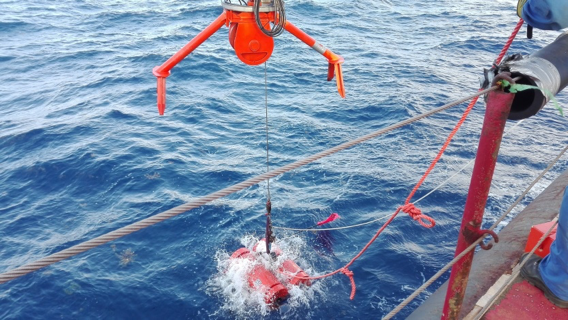
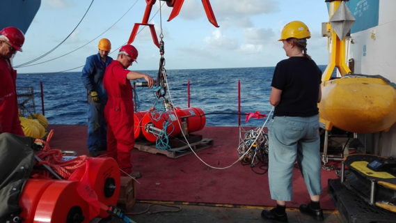
Each survey will be acquired with a (hopefully!) slick methodical approach. In the first sail along survey line 1, 48 ocean bottom seismometers (OBS) are deployed – 25 belonging to the Ocean Bottom Instrument Consortium (OBIC), and a further 23 to German Pool of Amphibious Seismic Instruments (DEPAS). They are designed to only sit 3.4km apart on the ocean floor and so the deployment turnaround time is rapid, with as many as four instruments going overboard each hour. With their drop-off locations carefully noted, the OBS may take 1-2hrs to sink to the sea bed (which in many cases is as much as 5600-5700m deep) and a further 4hrs to balance before recording. Having only ever done fieldwork with a simple hammer source and geophones in a single line of acquisition, it was great to see the equipment set up in action. All the basic principles of seismic waves penetrating the Earth are the same, but in this case on a much larger scale. Across just 1×24 hour cycle of watch keeping shifts, I am pleased to say all the OBS were successfully deployed and the team can move on to stage 2 of acquisition for this survey line.
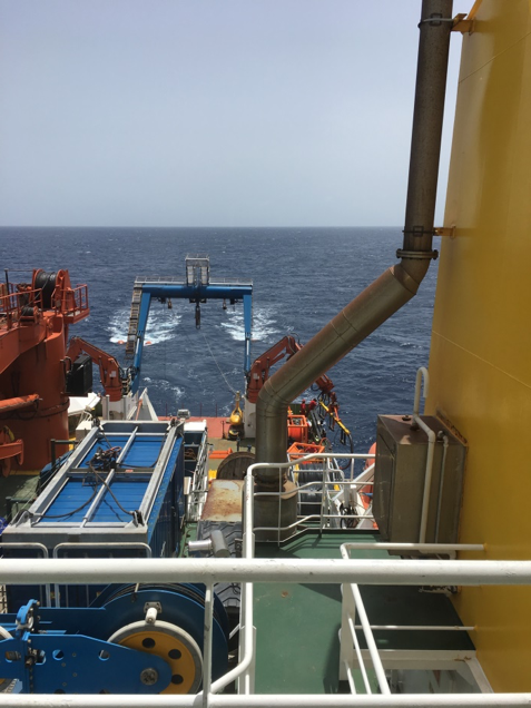
We will now shoot active source seismic using a 13-gun array, releasing 5000 cubic inches of high pressure gas to generate the pressure waves which will travel deep down beneath the sea bed and into the Earth. Our newly deployed OBS will act as receivers, recording the waves as they return. With no marine mammals sighted in the shooting area, the boat-shaking bang every 60 seconds confirms as I sit here writing, that all is going as planned and the air gun will continue firing for a further 16 hours along this survey line. Where the first line of shooting will aim to record the refraction properties of the seismic waves at the newly deployed OBS, a 3km towed streamer of hydrophones will be used to record the reflected waves on the return journey. The properties of the recorded returning waves including their amplitude, phase and arrival time is what we use to then interpret the subsurface and learn about its structure. The third and final stage of the acquisition process is to collect all the OBS again and repeat for a further two lines.
Aside from the seismic acquisition, there are instruments on board recording gravity magnetics and sea floor bathymetry. Some of these methods and the regional geology can be quite complex and I’ll come back to these in more detail as the weeks go on. In the meanwhile, those recovering from jetlag and seasickness begin a new battle with airgun insomnia. Just when you think they may have finished firing… BANG.